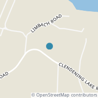
91930 99940 Mcdonald Dr, Freeport OH 43973
Public RecordsThe property at 91930 99940 Mcdonald Dr, built in 1981, is a 780 square foot Residence and has 2 bedrooms and 2 bathrooms. It is situated on a lot that is 52708 square feet and was last tax assessed in 2023 for a valuation of $43,450
The estimate for this property has experienced a -0.15% decrease in the past 7 months reaching a value of $75,888.
- Parcel Number30-0000837.000
- CountyHARRISON
- Stories1
Property Tax History
Source: Public Records
| Year | Assessment |
|---|---|
| 2023 | $15,210 +8.18% |
| 2022 | $14,060 |
| 2021 | $14,060 |
| 2020 | $14,060 +11.68% |
| 2019 | $12,590 |
| 2018 | $12,590 |
| 2017 | $12,590 +14.56% |
| 2016 | $10,990 |
| 2015 | $10,990 +1.20% |
| 2013 | $10,860 |
Valuation History
Source: Public Records
*Market History, including Median Sales Price per square foot, and Single Family Homes Sold is based on historical data of Zip Code: 43973 - OH
Population & Environment
Source: Sperling's Best Places
Nearby Properties
-
![Photo of 75800 Freeport Tipp Road]() $215,000 Active
$215,000 Active4 bds • 2 ba • 0 sqft
75800 Freeport Tipp Road, Freeport, OH 43973
Vinyl sided ranch with 4 bedrooms and 1 1/2 baths. This home sits on 4.303 fenced in acres. The kitchen/dining area is open concept and is a nice size for a large gathering. There is ample cabinets and the appliances are included as well. The living... -
![Photo of 78560/78500 Kinsey Orchard Road]() $399,000 Active
$399,000 Active4 bds • 4 ba • 1,943 sqft
78560/78500 Kinsey Orchard Road, Freeport, OH 43973
WOW! This 4 bedroom, 3.5 bath 2018 built ranch home with convenient attached 2 car garage on nearly 6 acres (over 4 parcels) is what everyone is looking for. Featuring almost 2,000 square feet on the first floor with an open floor plan makes you feel... -
![Photo of N Philadelphia Rear]() $26,000 Active
$26,000 Active0 bds • 0 ba • 0 sqft
N Philadelphia Rear, Freeport, OH 43973
Level corner city lot with tons of potential. Property could be utilized as a new building site for your dream home, a future business, storage units and, so many more endless possibilities. City utilities are available water, sewer, gas, and electri... -
![Photo of 33080 Cadiz Piedmont Road]() $240,000 Active
$240,000 Active0 bds • 0 ba • 5,600 sqft
33080 Cadiz Piedmont Road, Piedmont, OH 43983
WOW... PRICED RIGHT... Great Possibilities for this Level.. Great Access.. Prime Location on SR 22 with almost 6 Acres and 2 Structures already waiting for any type of Use. Come See this 100ft x 50ft All Metal 20ft High Ceilings with 3 Large Ba... -
![Photo of 120 W Main Street]() $92,500 Active
$92,500 Active3 bds • 2 ba • 1,454 sqft
120 W Main Street, Freeport, OH 43973
NICELY UPDATED 2 STORY ON THE EDGE OF TOWN. BIG FRONT PORCH WAITING FOR THE ROCKING CHAIRS. ENTER THE FRONT DOOR TO A BEAUTIFUL SPACIOUS LIVING ROOM WITH OAK HARDWOOD FLOORS AND A DECORATIVE OLD FIREPLACE. OPEN STAIRCASE TO THE SECOND LEVEL. FORMAL... -
![Photo of 30600 Ymca]() $225,000 Active
$225,000 Active0 bds • 0 ba • 0 sqft
30600 Ymca, Tippecanoe, OH 44699
A beautiful tract of hunting land in a very desirable area that could be the sight of your dream home? Thats what what's available with this one! Buy this and have the added bonus of walking across the street to hundreds of acres of public hunting. W... -
![Photo of 26057 Cadiz Road]() $145,000 Active
$145,000 Active2 bds • 1 ba • 0 sqft
26057 Cadiz Road, Freeport, OH 43983
Welcome to 26057 Cadiz Road! This property boasts with a unique, rustic, all American personality. This home is a well-preserved time capsule! The updates that have been done were meticulous in order to keep the personality of the home alive. You'll... -
![Photo of 73797 Freeport Road]() $139,000 Active
$139,000 Active2 bds • 2 ba • 1,028 sqft
73797 Freeport Road, Piedmont, OH 43983
This Brick ranch is nestled on almost 1/2 an acre, offering 2 bedrooms, 1 1/2 bathrooms, Living room with fireplace, Spacious kitchen with lots of cabinets, full unfinished basement with walkout door to the backyard. The yard comes complete with stor... -
![Photo of 27762 Norris Road]() $260,000 Active
$260,000 Active2 bds • 2 ba • 0 sqft
27762 Norris Road, Tippecanoe, OH 44699
Welcome to 27762 Norris Rd! Situated in the countryside of Tippecanoe, Ohio, and in the Hills of Eden private community this home offers a permanent or vacation spot without the hustle and bustle of the city. Conveniently located near multiple lakes... -
![Photo of 34683 Sunshine Road]() $489,900 Active
$489,900 Active0 bds • 0 ba • 0 sqft
34683 Sunshine Road, Piedmont, OH 43983
54.22 gorgeous acres for your own personal use, hunting, camping, boating, and relaxation. Located next to Piedmont Lake, where you have wonderful fishing opportunities as state record fish have been caught there. Just 20-25 minutes from I-70 as well... -
![Photo of Norris Road]() $333,700 Active
$333,700 Active0 bds • 0 ba • 0 sqft
Norris Road, Tippecanoe, OH 44699
Looking for a nice property to build on, schedule your private tour of this property today! -
![Photo of 33752 Goodrich Drive]() $305,000 Active
$305,000 Active3 bds • 1 ba • 1,080 sqft
33752 Goodrich Drive, Piedmont, OH 43983
Your next LAKE HOME awaits! This fully furnished move in ready property is furnished, turn key and ready for you to enjoy your next getaway. There's room for everyone with a spacious top loft fit with 2 queen sized beds and 2 more bedrooms split by a... -
![Photo of 409 Ashton Street]() $24,698 Active
$24,698 Active3 bds • 1 ba • 0 sqft
409 Ashton Street, Holloway, OH 43985
Court Ordered Sale by Private Selling Officer. All information we have on the property is included. We have no additional information, property condition is unknown. NO SHOWINGS, NO trespassing for any reason. No contingencies permitted, Sold 100% as... -
![Photo of 313 Clark Street]() $55,000 Active
$55,000 Active3 bds • 1 ba • 1,428 sqft
313 Clark Street, Holloway, OH 43977
Affordable 3-bedroom home on a corner lot. Great location close to 3 MWCD lakes. Enough garage space to store your boat. This home includes a 2 car and a 1-car detached garage. This home is selling as is -
![Photo of Holloway Rd/State Rt 331]() $27,000 Active
$27,000 Active0 bds • 0 ba • 0 sqft
Holloway Rd/State Rt 331, Flushing, OH 43977
Back on the Market! Piedmont Lake! Just over 1.5 acres, this piece of land has a partial clearing surrounded by mature trees perfect to build on or to camp and get away for the weekend! Easy access to US-22 and minutes from the lake to fish, hike and... -
![Photo of 40580 Cadiz Piedmont St Rt 22 Rd]() $125,000 Active
$125,000 Active0 bds • 0 ba • 8,308 sqft
40580 Cadiz Piedmont St Rt 22 Rd, Cadiz, OH 43907
What a great place to start a business of your choice or to house your current business that has out grown its location. Over 8000 sq ft total in the original 1956 building and the 1979 addition. All on 2.88 acres. Also with a mobile home pad. This... -
![Photo of 31380 Cadiz Dennison Rd]() $399,900 Active
$399,900 Active0 bds • 0 ba • 0 sqft
31380 Cadiz Dennison Rd, Uhrichsville, OH 44683
Location, location, location! This unique acreage adjoining Tappan Lake with a quaint farmhouse and antique barn is awaiting a new owner with a vision of creating a personal year-round hunting and recreational getaway or an income-producing vacation... -
![Photo of SE Feed Spring Hill Road]() $256,400 Active
$256,400 Active0 bds • 0 ba • 0 sqft
SE Feed Spring Hill Road, Uhrichsville, OH 44683
Attached is a Forestry Plan completed in 2020; filled with red oaks, hackberry, yellow poplar, sassafras, black oak, big tooth, hickory, aspen and black walnut. Come and see this 28.64 acres that is perfect for recreational use such as hunting or tr... -
![Photo of 7812 Moores Ridge Road SE]() $69,900 Active
$69,900 Active0 bds • 0 ba • 0 sqft
7812 Moores Ridge Road SE, Uhrichsville, OH 44683
Attached is a Forestry Plan completed in 2020; filled with red oaks, hackberry, yellow poplar, sassafras, black oak, big tooth, hickory, aspen and black walnut. This 5.253 acres has plenty of road frontage to build your new home or weekend getaway.... -
![Photo of 1 Meadowood Trail]() $14,900 Active
$14,900 Active0 bds • 0 ba • 0 sqft
1 Meadowood Trail, Scio, OH 43988
Land for sale in Harrison County, Ohio. Two miles from Lake Tappan. Very nice wooded lot with mature trees and lots of wildlife. Great for a family getaway. Three wooden outbuildings for storage. Adjoining wooded lots, averaging just over one ac...


