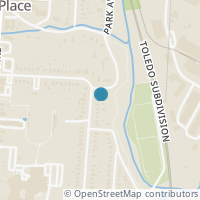
1126 Burns Ave, Wyoming OH 45215
Public RecordsThe property at 1126 Burns Ave, built in 1922, is a 1,250 square foot Residence and has 2 bedrooms and 1 bathrooms. It is situated on a lot that is 8102 square feet and was last tax assessed in 2022 for a valuation of $145,340
The estimate for this property has experienced a 53.94% increase in the past 6 months reaching a value of $341,204.
- Parcel Number592-0006-0001-00
- CountyHAMILTON
- Stories2
- Home Assessment$54,005
- Land Assessment$53,530
- Total Assessment$207,830
- Assessment Year2023
- Tax Year2023
- Tax Amount$3,998
Property Tax History
Source: Public Records
| Year | Assessment |
|---|---|
| 2022 | $50,869 |
| 2021 | $50,869 |
| 2020 | $50,869 +16.00% |
| 2019 | $43,852 |
| 2018 | $43,852 |
| 2017 | $43,852 +8.98% |
| 2016 | $40,240 |
| 2015 | $40,240 |
| 2014 | $40,240 +2.01% |
| 2013 | $39,449 |
Valuation History
Source: Public Records
*Market History, including Median Sales Price per square foot, and Single Family Homes Sold is based on historical data of Zip Code: 45215 - OH
Nearby Schools
Source: School Digger
Population & Environment
Source: Sperling's Best Places
Click Zestimate price to view details on Zillow. Zestimate data is provided "as is" via the Zestimate API. © Zillow, Inc., 2006-2022. Use is subject to Terms of Use.
Nearby Properties
-
![Photo of 22 Chestnut Avenue]() $300,000 Active
$300,000 Active3 bds • 2 ba • 0 sqft
22 Chestnut Avenue, Cincinnati, OH 45215
Brick, 3-bedroom 2 full bath Cape Cod home. Some updates, featuring a 1st floor large Primary bedroom suite with walk-out to a spacious deck. This room could also be used as a family room and the study could become the 3rd bedroom. First floor bathro... -
![Photo of 318 Wilmuth Avenue]() $419,900 Active
$419,900 Active4 bds • 2 ba • 1,190 sqft
318 Wilmuth Avenue, Wyoming, OH 45215
-
![Photo of 631 Mulberry Street]() $1,000 Active
$1,000 Active2 bds • 2 ba • 800 sqft
631 Mulberry Street, Cincinnati, OH 45215
Turned one bedroom unit in this Lockland property. Section 8 and other third party payees welcome. Off-street parking, brand new boiler, heat and water paid by the owner. -
![Photo of 518 Wyoming Avenue]() $599,900 Active
$599,900 Active0 bds • 2 ba • 0 sqft
518 Wyoming Avenue, Wyoming, OH 45215
Amazing opportunity to purchase established upscale Lounge in Wyoming. Located in the business district of Wyoming which is now a DORA district. The slide up windows allow for indoor and outdoor service on the expanded sidewalk. The sale includes the... -
![Photo of 4 Rolling Hills Drive]() $275,000 Active
$275,000 Active3 bds • 2 ba • 2,000 sqft
4 Rolling Hills Drive, Wyoming, OH 45215
Totally remodeled Condo w/fresh paint at a great price! Kitchen w/ Quartz Counters, SS Appliances, Tile FL, Recessed Lights, Pantry w/ Built ins, 3rd BR is set up as a work out area! 2 Murphy beds. LL walkout to patio. 1st FL BR has new full bath. 2... -
![Photo of 700 W Wyoming Avenue]() $200,000 Active
$200,000 Active0 bds • 0 ba • 0 sqft
700 W Wyoming Avenue, Lockland, OH 45215
Multiple options for storefront building on main strip of combined residential and business district on the border of Lockland & Wyoming neighborhoods. Currently utilized as a renovated church worship center, this property offers many opportunities f... -
![Photo of 1215 Behles Avenue]() $155,000 Active
$155,000 Active3 bds • 1 ba • 966 sqft
1215 Behles Avenue, Cincinnati, OH 45215
This updated 3bd 1bath home, comes with new windows, new carpet, new paved driveway, new roof and gutters, new hot water heater and HVAC unit. A perfect starter home. Ready to move in. -
![Photo of 777 Jackson Street]() $115,000 Active
$115,000 Active2 bds • 1 ba • 870 sqft
777 Jackson Street, Lincoln Heights, OH 45215
This Home is in need of complete renovation. Owner believes that adjoining lot is buildable. -
![Photo of 1348 Behles Avenue]() $89,900 Active
$89,900 Active3 bds • 1 ba • 1,100 sqft
1348 Behles Avenue, Cincinnati, OH 45215
Great opportunity to pick up a low cost investment. Property is tenant occupied and requires a 24 hour notice. Property had mold in kitchen and has since had the plumbing issue corrected that was causing the mold. Will require a cash offer or 203k re... -
![Photo of 436 Linden Drive (Lot 15)]() $47,000 Active
$47,000 Active0 bds • 0 ba • 0 sqft
436 Linden Drive (Lot 15), Pemberville, OH 43450
Lot located in Pember Grove Sub Division in Pemberville. Large lots, public utilities, fiber optic internet, and the Eastwood School System are all a bonus. Pember Grove is adjacent to the bike/walking trail, and close to public parks with tennis, pi... -
![Photo of 342 Springfield Pike]() $417,800 Active
$417,800 Active5 bds • 2 ba • 2,354 sqft
342 Springfield Pike, Cincinnati, OH 45215
Situated away from the road, near the village & center of town, this large home is in a prime location w/an exceptional, large, flat yard. Wyoming Schools! Relaxing front porch w/privacy. Spacious rooms, large kitchen w/ 1st floor mud room/laundry. P... -
![Photo of 1105 Chatham Court]() $29,900 Active
$29,900 Active0 bds • 0 ba • 0 sqft
1105 Chatham Court, Cincinnati, OH 45215
Vacant land opportunity in beautiful Wyoming. Corner, wooded lot. Land is NOT able to be built on per the City of Wyoming. Motivated seller, BRING AN OFFER! -
![Photo of 10088 Springfield Pike #4]() $1,700 Active
$1,700 Active0 bds • 0 ba • 1,752 sqft
10088 Springfield Pike #4, Cincinnati, OH 45215
Retail space 1752 square feet and 20x20 office available with five suites and private office. Open floor plan on very busy street with 45 parking spaces. $1,700 per month plus NNN. -
![Photo of 421 Linden Drive (Lot 1)]() $48,000 Active
$48,000 Active0 bds • 0 ba • 0 sqft
421 Linden Drive (Lot 1), Pemberville, OH 43450
Lot located in Pember Grove Sub Division in Pemberville. Large lots, public utilities, fiber optic internet, and the Eastwood School System are all a bonus. Pember Grove is adjacent to the bike/walking trail, and close to public parks with tennis, pi... -
![Photo of 427 Linden Drive (Lot 6)]() $50,000 Active
$50,000 Active0 bds • 0 ba • 0 sqft
427 Linden Drive (Lot 6), Pemberville, OH 43450
Lot located in Pember Grove Sub Division in Pemberville. Large lots, public utilities, fiber optic internet, and the Eastwood School System are all a bonus. Pember Grove is adjacent to the bike/walking trail, and close to public parks with tennis, pi... -
![Photo of 214 Springfield Pike]() $735,000 Active
$735,000 Active4 bds • 3 ba • 2,918 sqft
214 Springfield Pike, Cincinnati, OH 45215
Stunning, classic Victorian in the historic heart of Wyoming. Easy access to the amenities of downtown Wyoming. The owners improvements respected the home's original style while making it a place for contemporary living. Entertain and relax on the sp... -
![Photo of 2 Prairie Avenue]() $80,000 Active
$80,000 Active0 bds • 0 ba • 0 sqft
2 Prairie Avenue, Cincinnati, OH 45215
Expansive vacant land which creates a blank canvas for your imagination. It offers endless possibilities for the development of your future home and awaits your vision to bring it to life. Owned by one family since 1957. There are three neighboring l... -
![Photo of 3 Prairie Avenue]() $80,000 Active
$80,000 Active0 bds • 0 ba • 0 sqft
3 Prairie Avenue, Cincinnati, OH 45215
Expansive vacant land which creates a blank canvas for your imagination. It offers endless possibilities for the development of your future home and awaits your vision to bring it to life. Owned by one family since 1957. There are three neighboring l... -
![Photo of 1 Prairie Avenue]() $80,000 Active
$80,000 Active0 bds • 0 ba • 0 sqft
1 Prairie Avenue, Cincinnati, OH 45215
Expansive vacant land which creates a blank canvas for your imagination. It offers endless possibilities for the development of your future home and awaits your vision to bring it to life. Owned by one family since 1957. There are three neighboring l... -
![Photo of 0 Ashley Lane]() $72,500 Active
$72,500 Active0 bds • 0 ba • 0 sqft
0 Ashley Lane, Wyoming, OH 45215
Build your dream home in Wyoming. Amazing opportunity! Flat lot.


