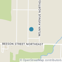
10606 Barcus Ave NE, Alliance OH 44601
Public RecordsThe property at 10606 Barcus Ave NE, built in 1959, is a 1,152 square foot Residence and has 3 bedrooms and 1 bathrooms. It is situated on a lot that is 20038 square feet and was last tax assessed in 2022 for a valuation of $111,200
The estimate for this property has experienced a -21.15% decrease in the past 6 months reaching a value of $144,660.
- Parcel Number28-01208
- Sold Date10/28/2019
- Sold Price$100,000
- CountySTARK
- Stories1
- Home Assessment$27,300
- Land Assessment$33,200
- Total Assessment$111,200
- Assessment Year2022
- Tax Year2023
- Tax Amount$1,403
Property Tax History
Source: Public Records
| Year | Assessment |
|---|---|
| 2022 | $38,920 |
| 2021 | $38,920 +35.42% |
| 2020 | $28,740 |
| 2019 | $28,740 -7.77% |
| 2018 | $31,160 +110.40% |
| 2017 | $14,810 -55.19% |
| 2016 | $33,050 |
| 2015 | $33,050 +20.71% |
| 2014 | $27,380 |
| 2013 | $27,380 |
Valuation History
Source: Public Records
*Market History, including Median Sales Price per square foot, and Single Family Homes Sold is based on historical data of Zip Code: 44601 - OH
Nearby Schools
Source: School Digger
Population & Environment
Source: Sperling's Best Places
Nearby Properties
-
![Photo of 10410 Freshley Ave NE]() $300,000 Active
$300,000 Active4 bds • 2 ba • 0 sqft
10410 Freshley Ave NE, Alliance, OH 44601
The duplex's are both currently rented. They sit on peaceful country lot that is wooded with a stream at the rear of the lot. You are only 2 miles from State St. and all its amenities. This would be a great income property or owner occupied!! -
![Photo of 13060 Beeson St NE]() $248,000 Active
$248,000 Active3 bds • 2 ba • 1,696 sqft
13060 Beeson St NE, Alliance, OH 44601
Welcome to this fantastic Bungalow located in a quiet and peaceful country setting. This family friendly home is bursting with loads of charm and character around every corner. Enjoy entertaining intimate or large gatherings in the open design kitche... -
![Photo of 9540 Mccallum Avenue NE]() $250,000 Active
$250,000 Active0 bds • 0 ba • 9,800 sqft
9540 Mccallum Avenue NE, Alliance, OH 44601
Approx. 9,800 sq ft building on 5 plus acres with 24x5 pole barn and pavilion, Call for details or to schedule a private showing -
![Photo of 885 S Sawburg Avenue #101]() $12 Active
$12 Active0 bds • 0 ba • 2,350 sqft
885 S Sawburg Avenue #101, Alliance, OH 44601
Prime location on well traveled street, plenty of parking, immediate occupancy. Great space for medical or professional office. 2350 square feet, other units available. -
![Photo of 885 S Sawburg Avenue #110]() $12 Active
$12 Active0 bds • 0 ba • 2,350 sqft
885 S Sawburg Avenue #110, Alliance, OH 44601
Prime location on well traveled street, plenty of parking, immediate occupancy. Great space for medical or professional office. 2250 square feet, other units available. -
![Photo of 885 S Sawburg Avenue #108]() $12 Active
$12 Active0 bds • 0 ba • 4,000 sqft
885 S Sawburg Avenue #108, Alliance, OH 44601
Prime location on well traveled street, plenty of parking, immediate occupancy. Great space for medical or professional office. 3800 square feet, other units available. -
![Photo of 885 S Sawburg Avenue #104]() $12 Active
$12 Active0 bds • 0 ba • 1,779 sqft
885 S Sawburg Avenue #104, Alliance, OH 44601
Prime location on well traveled street, plenty of parking, immediate occupancy. Great space for medical or professional office. 1790 square feet, other units available. -
![Photo of Sawburg Avenue S]() $119,900 Active
$119,900 Active0 bds • 0 ba • 0 sqft
Sawburg Avenue S, Alliance, OH 44601
-
![Photo of 2031 Crestwood Street]() $314,900 Active
$314,900 Active3 bds • 2 ba • 2,325 sqft
2031 Crestwood Street, Alliance, OH 44601
Spacious Ranch Home - 3 Bedroom, 2 Bath - Westwood Farm Neighborhood - Marlington Local Schools - Built in 1995 by SchumacherHomes with 1,750 sq ft of living area on the main level. Great room with vaulted ceiling and gas fireplace. Open kitchen and... -
![Photo of 1469 W Main Street]() $699,000 Active
$699,000 Active0 bds • 0 ba • 27,418 sqft
1469 W Main Street, Alliance, OH 44601
Industrial warehouse approximately 28,000 sq. ft. Building. 20 ft. high ceilings, 4 sections to the building currently but could be open more if needed. Lots of parking in front and beside the building. One loading dock currently and 2 ground height... -
![Photo of 1310,1330,1350 Mishler Street NE]() $750,000 Active
$750,000 Active0 bds • 0 ba • 0 sqft
1310,1330,1350 Mishler Street NE, Alliance, OH 44601
Three multi-unit buildings with 4 units in each building. Carports for each building. Each unit has 2 bedrooms, and 1 bath plus each building has a coin-operated washer and dryer to remain. 2015 new metal roofs on the 3 apartment buildings. All units... -
![Photo of 586 Briarcliff Avenue]() $289,900 Active
$289,900 Active4 bds • 3 ba • 2,514 sqft
586 Briarcliff Avenue, Alliance, OH 44601
Check out this well-maintained home in Marlington School District. The home features all-new paint, lighting, a refrigerator, fencing, and master bath. There are 4 bedrooms, 2 1/2 baths, and over 2,500 sq ft of living space. Call to schedule a showin... -
![Photo of Klinger Avenue]() $19,900 Active
$19,900 Active0 bds • 0 ba • 0 sqft
Klinger Avenue, Alliance, OH 44601
Two parcels, sell together. Water and sewer are available. Approximately 1.12 acres. 277 ft x 271 ft total. Irregular shape. -
![Photo of Columbus Road NE]() $90,000 Active
$90,000 Active0 bds • 0 ba • 0 sqft
Columbus Road NE, Louisville, OH 44641
-
![Photo of 1850 S Sawburg Road]() $240,000 Active
$240,000 Active3 bds • 3 ba • 1,776 sqft
1850 S Sawburg Road, Alliance, OH 44601
This property boasts a sunroom with a beam and ceiling fan, flooding the space with natural light. With numerous windows throughout, it offers picturesque views and a bright ambiance. The master ensuite includes two closets for ample storage, while a... -
![Photo of Edison Street]() $40,000 Active
$40,000 Active0 bds • 0 ba • 0 sqft
Edison Street, Alliance, OH 44601
Previous parcel # 028-00953 and # 028-00954 that has been combined by Stark County Auditor. Soil testing has been done and the results are in supplements. Discover a prime opportunity within the Marlington School District: 2 acres of buildable land... -
![Photo of 10440 Columbus Road NE]() $299,000 Active
$299,000 Active2 bds • 1 ba • 0 sqft
10440 Columbus Road NE, Louisville, OH 44641
If you are looking for country living yet close enough to all your shopping needs, then this house is for you. Located in Marlboro Township and Marlington School district. Approx 1 mile from the HS and Middle School. This 2 bedroom/ 1 bath home sits... -
![Photo of Main Street W]() $29,900 Active
$29,900 Active0 bds • 0 ba • 0 sqft
Main Street W, Alliance, OH 44601
-
![Photo of Queensbury Road]() $40,000 Active
$40,000 Active0 bds • 0 ba • 0 sqft
Queensbury Road, Alliance, OH 44601
Welcome to Washington Hills, just 2 1/2 miles from Rt 62, improved lots with winding tree lined streets. Country atmosphere but close to amenities. Wonderful lots-bring your own builder or we can assist you in finding the right builder for your new h... -
![Photo of 1595 Fernwood Boulevard]() $269,900 Active
$269,900 Active4 bds • 3 ba • 1,959 sqft
1595 Fernwood Boulevard, Alliance, OH 44601
Location location location! This Gem waits for the perfect buyer to move and give it their own TCL. All brick split level with 4 bedrooms and 2 1/2 baths. Family room, living room and fireplace, dining room and kitchen. Appliances all stay! Large lot...


