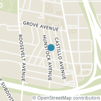
612 Hunstock Ave, San Antonio TX 78210
Public RecordsThe property at 612 Hunstock Ave, built in 1910, is a 1,588 square foot Residence and has 3 bedrooms and 2 bathrooms. It is situated on a lot that is 6665 square feet and was last tax assessed in 2023 for a valuation of $368,320
The estimate for this property has experienced a -3.24% decrease in the past 7 months reaching a value of $387,040.
- Parcel Number03129-010-0680
- Sold Date05/18/2023
- Sold PriceUnknown/Redacted
- CountyBEXAR
- Stories1
- Home Assessment$125,010
- Land Assessment$243,310
- Total Assessment$368,320
- Assessment Year2023
- Tax Year2023
- Tax Amount$9,181
Property Tax History
Source: Public Records
| Year | Assessment |
|---|---|
| 2023 | $368,320 |
| 2022 | $368,320 |
| 2021 | $368,320 +23.13% |
| 2020 | $299,140 -6.72% |
| 2019 | $320,680 +14.73% |
| 2018 | $279,500 +138.10% |
| 2017 | $117,390 +0.14% |
| 2016 | $117,230 +8.77% |
| 2015 | $107,780 +24.30% |
| 2013 | $86,710 |
Valuation History
Source: Public Records
*Market History, including Median Sales Price per square foot, and Single Family Homes Sold is based on historical data of Zip Code: 78210 - TX
Nearby Schools
Source: School Digger
Population & Environment
Source: Sperling's Best Places
Nearby Properties
-
![Photo of 2419 S Presa St 201 #201]() $900 Active
$900 Active0 bds • 1 ba • 400 sqft
2419 S Presa St 201 #201, San Antonio, TX 78210
Come take a look at this beautiful 1 bedroom apartment with 1 bathroom. Conveniently located close to 281 and minutes from downtown! Enjoy high ceilings & huge windows for natural lightning!! Close to many restaurants! Water included! -
![Photo of 317 CASTILLO AVE A #A]() $895 Active
$895 Active1 bds • 1 ba • 600 sqft
317 CASTILLO AVE A #A, San Antonio, TX 78210
Spacious 1 bedroom 1 bath downstairs apartment in a secured access building for rent. Small quite complex. 1 off street parking spot, -
![Photo of 124 HAYNES AVE]() $547,500 Active
$547,500 Active3 bds • 3 ba • 1,918 sqft
124 HAYNES AVE, San Antonio, TX 78210
This expertly remodeled craftsman home is blocks from the SA River, Downtown, Hemisfair, Blue Star and is ready for move-in! In addition to the almost 2,000 sqft 3 bedroom, 2.5 bath main house, there is a stand alone ADU for additional rental income... -
![Photo of 205 LORETTA PL]() $265,000 Active
$265,000 Active2 bds • 1 ba • 908 sqft
205 LORETTA PL, San Antonio, TX 78210
** OPEN HOUSE SUN 4/7 FROM 12-3** Nestled in the cozy craftsman aesthetic, this home is just minutes from Roosevelt Park, the San Antonio River, and the city center. Ample-covered parking is available at the rear, accompanied by a plethora of storage... -
![Photo of 702 ROOSEVELT AVE]() $690,000 Active
$690,000 Active0 bds • 0 ba • 0 sqft
702 ROOSEVELT AVE, San Antonio, TX 78210
Tons of potential, located in the Roosevelt Park historic district. Close to Mission River Reach, Art District, Restaurants, Bars. Auto Repair shop for over 40 years now Zoned C-1; light commercial districts accommodate neighborhood commercial uses w... -
![Photo of 307 WILKENS AVE]() $2,700 Active
$2,700 Active3 bds • 2 ba • 1,560 sqft
307 WILKENS AVE, San Antonio, TX 78210
This amazing bungalow is now available for rent! All the updates have been completed and is ready for the entertainer in you! The original beams exposed in the spacious living room along with a fireplace are very welcoming! The dining area is also sp... -
![Photo of 115 E Highland Blvd]() $265,000 Active
$265,000 Active3 bds • 2 ba • 1,920 sqft
115 E Highland Blvd, San Antonio, TX 78210
Great Investment Opportunity (SOLD AS-IS) Home built in 1925 with detached side garage with attached "Casita" with living/bedroom, kitchen & bath. Minutes from downtown, Southtown, Lavaca, King William, Blue Star area and the river walk. -
![Photo of 222 Wilkens]() $399,900 Active
$399,900 Active3 bds • 3 ba • 2,862 sqft
222 Wilkens, San Antonio, TX 78210
*ALSO AVAILABLE FOR RENT MLS#1757337 Beautifully restored and located near downtown, King William, Lavaca Districts, and the river. 3 beds/2.5 baths, 2 dining areas, multiple living areas. The island kitchen features stainless appliances, a glass til... -
![Photo of 210 WILKENS AVE]() $555,000 Active
$555,000 Active6 bds • 3 ba • 2,884 sqft
210 WILKENS AVE, San Antonio, TX 78210
Located in the center of Southtown/Roosevelt, within walking distance of Lone Star Brewery, Roosevelt Park, Art Complex, King William District, and minutes from The Riverwalk, Hemisfair Park, La Villita, and all the downtown amenities. This duplex wa... -
![Photo of 215 BERKSHIRE]() $374,999 Active
$374,999 Active2 bds • 2 ba • 1,128 sqft
215 BERKSHIRE, San Antonio, TX 78210
Stunningly renovated home in the vibrant neighborhood of Southtown! With its fully furnished interior, this home presents an enticing opportunity for generating residual income. Whether you're looking to make this your dream home or seeking a lucrati... -
![Photo of 519 Roosevelt Ave]() $2,770,000 Active
$2,770,000 Active0 bds • 0 ba • 0 sqft
519 Roosevelt Ave, San Antonio, TX 78210
Turnkey 28 Townhome Lot development for sale in San Antonio Texas - 1.23 Acres - Fully approved Plat - Walk to Riverwalk Extension - Proximity to Roosevelt Park & Lone Star - All architectural, construction & civil plans included - Roads & Utilities... -
![Photo of 127 E WHITTIER ST]() $2,450 Active
$2,450 Active3 bds • 2 ba • 1,745 sqft
127 E WHITTIER ST, San Antonio, TX 78210
Welcome to this beautifully renovated 3-bedroom, 2-bathroom home nestled on the cusp of the coveted King Williams and Lavaca neighborhoods, just moments away from Downtown San Antonio's Pearl, Convention Center, and Alamo dome attractions. Step insid... -
![Photo of 551 W HIGHLAND BLVD]() $180,000 Active
$180,000 Active2 bds • 2 ba • 1,145 sqft
551 W HIGHLAND BLVD, San Antonio, TX 78210
This cute-as-a-button home is located just a few minutes from BlueStar District, the Riverwalk, and all the trendiest eateries on S. Alamo! The photos are reflective of the previous listing in 2019. With the right repairs and cosmetic updates, the ch... -
![Photo of 506 W DREXEL AVE 1 #1]() $825 Active
$825 Active1 bds • 1 ba • 740 sqft
506 W DREXEL AVE 1 #1, San Antonio, TX 78210
**NO PETS ALLOWED** Captivate your senses with this vibrant multiplex rental property. Boasting a spacious 740 sq ft, this charming unit offers a cozy and inviting atmosphere that creates a comfortable living space. The open floor plan seamlessly con... -
![Photo of 506 W Drexel Ave 3 #3]() $825 Active
$825 Active2 bds • 1 ba • 558 sqft
506 W Drexel Ave 3 #3, San Antonio, TX 78210
Welcome to this charming 2-bedroom, 1-bathroom multiplex unit offering comfort and style. As you enter, you'll notice a harmonious blend of wood and ceramic tile flooring, adding warmth and elegance to the space. The kitchen is equipped with essentia... -
![Photo of 307 MCKINLEY AVE]() $1,500 Active
$1,500 Active3 bds • 1 ba • 1,216 sqft
307 MCKINLEY AVE, San Antonio, TX 78210
This is a beautiful house in a natural environment area. This house is located nearest to the park, shopping, schools, etc. This house has enough space with many amenities. This house's condition is good currently. The rental price is very cheap (eac... -
![Photo of 314 E WHITTIER ST]() $120,000 Active
$120,000 Active3 bds • 1 ba • 1,216 sqft
314 E WHITTIER ST, San Antonio, TX 78210
Investor special! 2023 Tax Appraised Value is shown as $194k!! Large lot on a dead end street. Original home with large covered front porch. Additional converted living space and storage in the building behind the home. There is an attic room too tha... -
![Photo of 3.47± ACRES IN Mission del Lago]() $925,000 Active
$925,000 Active0 bds • 0 ba • 151,545 sqft
3.47± ACRES IN Mission del Lago, San Antonio, TX 78221
Nestled beside the Mission Del Lago Golf Course and surrounded by several new housing developments, this 3.47 AC piece of land presents a prime multi-family development opportunity in San Antonio's booming South Side. Its advantageous location next t... -
![Photo of 815 STEVES AVE]() $175,000 Active
$175,000 Active0 bds • 0 ba • 1,076 sqft
815 STEVES AVE, San Antonio, TX 78210
This is the perfect location for a small business on a busy corner with plenty of parking in the rear. The building has 4 large rooms, a kitchen, a full bath, and two storage rooms in the back. The seller is willing to renovate the interior to suit y... -
![Photo of 815 STEVES AVE]() $175,000 Active
$175,000 Active2 bds • 1 ba • 1,076 sqft
815 STEVES AVE, San Antonio, TX 78210
Great location on Steves Ave & Roosevelt, nice 2 bedroom with extra rooms for flex space. Large backyard/parking. Perfect for a home business, office, or retail. Seller will remodel to suit, such as add appliances, flooring, painting, remodel kitchen...


