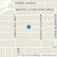
550 Lincolnshire Dr, San Antonio TX 78220
Public RecordsThe property at 550 Lincolnshire Dr, built in 1950, is a 884 square foot Residence and has 2 bedrooms and 1 bathrooms. It is situated on a lot that is 5489 square feet and was last tax assessed in 2023 for a valuation of $120,000
The estimate for this property has experienced a 28.98% increase in the past 7 months reaching a value of $143,300.
- Parcel Number10336-018-0130
- Sold Date03/11/2021
- Sold PriceUnknown/Redacted
- CountyBEXAR
- Stories1
- Home Assessment$79,090
- Land Assessment$15,750
- Total Assessment$94,840
- Assessment Year2021
- Tax Year2021
- Tax Amount$2,650
Property Tax History
Source: Public Records
| Year | Assessment |
|---|---|
| 2021 | $94,840 +11.43% |
| 2020 | $85,110 -10.26% |
| 2019 | $94,840 +41.66% |
| 2018 | $66,950 +252.74% |
| 2017 | $18,980 +2.58% |
| 2016 | $18,502 +10.00% |
| 2015 | $16,820 -24.57% |
| 2013 | $22,300 |
Valuation History
Source: Public Records
*Market History, including Median Sales Price per square foot, and Single Family Homes Sold is based on historical data of Zip Code: 78220 - TX
Nearby Schools
Source: School Digger
Population & Environment
Source: Sperling's Best Places
Click Zestimate price to view details on Zillow. Zestimate data is provided "as is" via the Zestimate API. © Zillow, Inc., 2006-2022. Use is subject to Terms of Use.
Nearby Properties
-
![Photo of 583 MORNINGVIEW DR]() $135,000 Active
$135,000 Active3 bds • 2 ba • 1,366 sqft
583 MORNINGVIEW DR, San Antonio, TX 78220
INVESTOR SPECIAL!!!!!.Welcome to this fantastic investment opportunity! Nestled on a spacious lot, this 3-bedroom, 2-bathroom home is an ideal choice for savvy investors looking to maximize their returns. -
![Photo of 343 Dorie St]() $173,900 Active
$173,900 Active4 bds • 1 ba • 1,004 sqft
343 Dorie St, San Antonio, TX 78220
Come and take a look at this Charming starter home! The home boast 4 bedrooms 1 bath with plenty of parking. Featuring a generous backyard a private fence and back patio for entertaining. Ideal for a small family or investor looking to enter the rent... -
![Photo of 907 YUCCA ST]() $50,000 Active
$50,000 Active0 bds • 0 ba • 0 sqft
907 YUCCA ST, San Antonio, TX 78220
Cleared Residentail Lot ready to build on. WATER AND SEWER SERVICES CONNECTIONS READY FOR YOU NEW HOME BUILD. 907 Yucca St. & 911 Yucca St. Two Lots side by side. -
![Photo of 594 Lincolnshire Dr]() $45,000 Active
$45,000 Active0 bds • 0 ba • 5,500 sqft
594 Lincolnshire Dr, San Antonio, TX 78220
Up kept Corner Lot! Perfect for building yourself a new home or investor potential. Close Access to major Highways and is located in a Established Neighborhood. -
![Photo of 910 Yucca St]() $48,000 Active
$48,000 Active0 bds • 0 ba • 0 sqft
910 Yucca St, San Antonio, TX 78220
Come see this awesome investment opportunity on a quiet street and at the end of a cul-de-sac. Located just minutes from downtown in a newly redeveloping area with new homes being built all around. This is a great opportunity for anyone looking to ge... -
![Photo of 518 STERLING ST]() $50,000 Active
$50,000 Active0 bds • 0 ba • 0 sqft
518 STERLING ST, San Antonio, TX 78220
Residential vacant land for sale -
![Photo of 926 Yucca St]() $74,500 Active
$74,500 Active0 bds • 0 ba • 0 sqft
926 Yucca St, San Antonio, TX 78220
Come and get your slice of San Antonio. One of the few properties ready to go with water and electric on site. Perfectly located near SH Gates Elementary and next to brand new homes across the street. This lot has excellent potential to build the hom... -
![Photo of 514 Sterling St]() $42,000 Active
$42,000 Active0 bds • 0 ba • 6,000 sqft
514 Sterling St, San Antonio, TX 78220
Ready to choose your builder and start your dream home in the established Wheatley Heights neighborhood. Easy access to churches, schools, eateries, downtown, AT & T Center, Alamodome, and IH 10. -
![Photo of 278 DORIE ST]() $225,000 Active
$225,000 Active3 bds • 2 ba • 1,375 sqft
278 DORIE ST, San Antonio, TX 78220
Welcome to your dream home! This stunning one-story property is a newly constructed masterpiece that offers the perfect blend of contemporary design, functionality, and comfort. As you step into the home, you'll be immediately struck by the airy and... -
![Photo of 3279 Martin Luther King Dr]() $44,000 Active
$44,000 Active0 bds • 0 ba • 0 sqft
3279 Martin Luther King Dr, San Antonio, TX 78220
NICE CORNER LOT READY FOR THE RIGHT INVESTOR / BUILDER. LOT LOCATION HAS SOME NEW BUILDS AROUND IT AND POTENTIAL. PLEASE VERIFY TAXES AND ALL RESTRICTIONS AND CITY REQUIREMENTS BEFORE SUBMITTING AN OFFER, DO ALL YOUR DUE DILIGENCE. SELLER HAS JUST CO... -
![Photo of 1603 Advance]() $173,500 Active
$173,500 Active3 bds • 2 ba • 1,100 sqft
1603 Advance, San Antonio, TX 78220
Open House 3/23/24, 2-4p.m. Spacious corner lot home. Updated with corner coffee bar with enclosed storage. Kitchen has closing barn door to allow for separation of living spaces. Nice size family room for guests and entertaining. Outdoor fire pit wi... -
![Photo of 3235 MARTIN LUTHER KING DR]() $159,900 Active
$159,900 Active3 bds • 1 ba • 1,195 sqft
3235 MARTIN LUTHER KING DR, San Antonio, TX 78220
Welcome Home! This home was recently renovated throughout with a neutral contemporary finishes throughout. The perfect starter home or rental investment for your portfolio.1 year old hot water heater, HVAC, and all appliances included! Quick access t... -
![Photo of 542 FERRIS AVE]() $35,000 Active
$35,000 Active0 bds • 0 ba • 0 sqft
542 FERRIS AVE, San Antonio, TX 78220
515 Ferris Ave.also available for a separate price. Wheatley Heights, Build your dream home or two in a very central location close to downtown and all the city attractions. New developments are going up in this area. -
![Photo of 455 FERRIS AVE]() $50,000 Active
$50,000 Active0 bds • 0 ba • 6,250 sqft
455 FERRIS AVE, San Antonio, TX 78220
INVESTMENT OPPORTUNITY! This spacious residential lot offers the perfect canvas for creating your next dream project. Zoned for residential use, this lot presents endless possibilities for custom construction or investment ventures. Prime Location ri... -
![Photo of 451 FERRIS AVE]() $185,000 Active
$185,000 Active3 bds • 2 ba • 1,248 sqft
451 FERRIS AVE, San Antonio, TX 78220
This Beautiful 3 bedroom, 2 bath house is ready for any buyer. This home offers an open spacious floor plan with a good lot size and fenced in backyard. Minutes from Alamo Colleges, Fort Sam Military Base with easy access to IH10 & 410. This home is... -
![Photo of 451 Ferrris Ave]() $185,000 Active
$185,000 Active3 bds • 2 ba • 1,248 sqft
451 Ferrris Ave, San Antonio, TX 78220
This Beautiful 3 bedroom 2 bath house is ready for any buyer. Minutes from Alamo Colleges Fort Sam Military Base with easy access to IH10 & 410. This home offers an open spacious floor plan with a good lot size and fenced in backyard. Recently update... -
![Photo of 538 CORLISS]() $99,900 Active
$99,900 Active3 bds • 2 ba • 1,020 sqft
538 CORLISS, San Antonio, TX 78220
3/2 Established Wheatley Heights home with four-sided vinyl siding and decorative window shutters ~ One story cozy home w/Mature trees in front and backyard ~ Spacious backyard with plenty of shade & great for entertaining. Ceiling fans throughout ~... -
![Photo of 430 CORLISS]() $25,000 Active
$25,000 Active0 bds • 0 ba • 0 sqft
430 CORLISS, San Antonio, TX 78220
Vacant lot now available! Next door to 2 completed new builds. Survey done, architect plans can be provided upon request. 3 bedroom 2 bathroom home 1350sqft, 2 car garage. Down the street from Martin Luther King Park! Development opportunity for a si... -
![Photo of 718 LINCOLNSHIRE DR]() $225,000 Active
$225,000 Active3 bds • 2 ba • 1,144 sqft
718 LINCOLNSHIRE DR, San Antonio, TX 78220
Fully renovated home ready for new owners! This home in an established neighborhood has a brand new private deck in the backyard perfect for entertaining along with a brand new kitchen and bathroom! Come see for yourself. -
![Photo of 475 CORLISS]() $234,900 Active
$234,900 Active3 bds • 2 ba • 1,304 sqft
475 CORLISS, San Antonio, TX 78220
This brand new construction home in the Wheatley Heights neighborhood is conveniently located near the ATT Center and minutes from downtown. This stunning home features wood look tile floors and granite countertops, providing style and easy maintenan...


