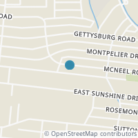
442 McNeel Rd, San Antonio TX 78228
Public RecordsThe property at 442 McNeel Rd, built in 1956, is a 1,797 square foot Residence and has 2 bedrooms and 2 bathrooms. It is situated on a lot that is 9801 square feet and was last tax assessed in 2021 for a valuation of $200,080
The estimate for this property has experienced a -4.23% decrease in the past 12 months reaching a value of $250,719.
- Parcel Number12126-009-0150
- Sold Date07/29/2020
- Sold PriceUnknown/Redacted
- CountyBEXAR
- Stories1
- Home Assessment$198,110
- Land Assessment$59,780
- Total Assessment$257,890
- Assessment Year2023
- Tax Year2022
- Tax Amount$4,096
Property Tax History
Source: Public Records
| Year | Assessment |
|---|---|
| 2022 | $240,000 -6.94% |
| 2021 | $257,890 +29.94% |
| 2020 | $198,463 +15.84% |
| 2019 | $171,330 +14.73% |
| 2018 | $149,338 +21.00% |
| 2017 | $123,420 +10.00% |
| 2016 | $112,200 +7.37% |
| 2015 | $104,500 +2.60% |
| 2013 | $101,850 |
Valuation History
Source: Public Records
*Market History, including Median Sales Price per square foot, and Single Family Homes Sold is based on historical data of Zip Code: 78228 - TX
Nearby Schools
Source: School Digger
Population & Environment
Source: Sperling's Best Places
Click Zestimate price to view details on Zillow. Zestimate data is provided "as is" via the Zestimate API. © Zillow, Inc., 2006-2022. Use is subject to Terms of Use.
Nearby Properties
-
![Photo of 874 E Sunshine Dr]() $1,900 Active
$1,900 Active3 bds • 3 ba • 1,401 sqft
874 E Sunshine Dr, San Antonio, TX 78228
Welcome to this modern 3-bedroom, 2.5 bathroom home located on the Central side of San Antonio. With its stylish design and convenient location, this property offers the ultimate combination of comfort and convenience. As you enter, you'll immediatel... -
![Photo of 3742 SUNSHINE RANCH RD]() $289,000 Active
$289,000 Active0 bds • 0 ba • 0 sqft
3742 SUNSHINE RANCH RD, San Antonio, TX 78228
Large lot located**Great Location** The property is level and mostly cleared** EXCELLENT OPPORTUNITY TO BUILD A DREAM HOME! Lots of new construction in the area. Excellent Investor/builder opportunity. Call agent for details. -
![Photo of 805 JOHN ADAMS DR]() $59,000 Active
$59,000 Active0 bds • 0 ba • 0 sqft
805 JOHN ADAMS DR, San Antonio, TX 78228
Your perfect lot to build awaits in the prestigious Woodlawn area! This prime residential lot is ready for your dream home. With utilities on-site and a ready-to-build foundation, the only limit is your imagination! Conveniently located just minutes... -
![Photo of 4207 WOODMANOR DR 2 #2]() $935 Active
$935 Active2 bds • 1 ba • 722 sqft
4207 WOODMANOR DR 2 #2, San Antonio, TX 78228
Nice 2 bedroom, 1 bathroom quaint home. Located on a quiet street, close to Longfellow Middle School and Lees Creek Park. Home includes central air/heat, refrigerator, range-oven, washer and dryer connections, and water is included in the rent. Home... -
![Photo of 829 JOHN ADAMS DR]() $279,000 Active
$279,000 Active3 bds • 2 ba • 1,575 sqft
829 JOHN ADAMS DR, San Antonio, TX 78228
Experience the epitome of comfort and style in this stunning single-story home boasting an open floor concept. Recently remodeled, this residence offers a blend of modern aesthetics and functional design. The bathrooms will be adorned with brand-new... -
![Photo of 855 John Adams]() $88,000 Active
$88,000 Active0 bds • 0 ba • 10,759 sqft
855 John Adams, San Antonio, TX 78228
Amazing corner lot is available for your new dream home! Almost a quarter acre of land with 144 feet of frontage! Great opportunity for the investor/builder who might want to subdivide the lot into two tracts and build two separate homes too. Many po... -
![Photo of 330 E Sunshine Dr 104 #104]() $895 Active
$895 Active2 bds • 2 ba • 930 sqft
330 E Sunshine Dr 104 #104, San Antonio, TX 78228
DOWNSTAIRS!!! UNIT 104 - 2 BEDROOM 2 BATH APARTMENT W/ REFRIGERATOR, STOVE, & DISHWASHER INCLUDED*WASHER/DRYER HOOKUPS*CENTRAL A/C & HEAT*LIVING AREA*DINING AREA*WATER INCLUDED*TENANT PAYS ELECTRIC & TRASH*$75 APP FEE NON REFUNDABLE*APP FEE, 1ST MONT... -
![Photo of 3603 LARKHILL]() $335,000 Active
$335,000 Active4 bds • 3 ba • 2,109 sqft
3603 LARKHILL, San Antonio, TX 78228
***OPEN HOUSE THIS SATURDAY APRIL 27TH, 2024 FROM 11AM TO 2PM***LOCATION LOCATION LOCATION!!!! Welcome to 3603 Larkhill! Beautiful and charming house located in a quiet and established neighborhood! It is conveniently located by Loop 410 and Ih10 int... -
![Photo of 1129 Shadwell Dr]() $995 Active
$995 Active2 bds • 1 ba • 800 sqft
1129 Shadwell Dr, San Antonio, TX 78228
NEAR WOODLAWN LAKE AND ST. MARY'S UNIVERSITY. UNIT COMES WITH REFRIGERATOR. 2 BEDROOM 1 BATH, WASHER, AND DRYER CONNECTION. PARK IS LOCATED NEXT DOOR!! ASK ABOUT OUR MOVE IN SPECIAL! -
![Photo of 719 JOHN PAGE DR]() $99,990 Active
$99,990 Active2 bds • 1 ba • 756 sqft
719 JOHN PAGE DR, San Antonio, TX 78228
**Investor Special**All offers due by Saturday April 27th at 5PM. 2 bedroom 1 bath home in Donaldon Terrace. Wood floors can be refinished and windows are all newer in good condition. Electric panels and pier and beam foundation updated in recent yea... -
![Photo of 138 McNeel Rd]() $277,000 Active
$277,000 Active3 bds • 2 ba • 1,325 sqft
138 McNeel Rd, San Antonio, TX 78228
MUST SEE !! This stunning one-story home. From the open-concept kitchen and living space to the large backyard, there is plenty of room for the whole family to enjoy. This very well-kept house with 3 bedrooms and 2 full baths, is just minutes away fr... -
![Photo of 227 Coyle Pl]() $225,000 Active
$225,000 Active3 bds • 2 ba • 1,630 sqft
227 Coyle Pl, San Antonio, TX 78201
One Story Home, nice fixer upper. Near Shopping and Minutes from Downtown. Owner finance available no set terms will need to put a down payment( MINIMUM OF 15 TO 20% )and terms will be arranged on an individual basis. Must see house first. -
![Photo of 843 ZACHRY DR]() $284,000 Active
$284,000 Active4 bds • 2 ba • 1,939 sqft
843 ZACHRY DR, San Antonio, TX 78228
As soon as you step inside you will notice the versatile, open floorplan. There is plenty of space for everyone, with 4 bedrooms and a flex space which could be used as a 5th bedroom, mother in-law suite, office space to work from home, or a family r... -
![Photo of 250 ROSEMONT DR]() $324,000 Active
$324,000 Active3 bds • 2 ba • 1,248 sqft
250 ROSEMONT DR, San Antonio, TX 78228
Welcome to your dream home in the heart of Jefferson Terrace. This recently remodeled one-story beauty boasts modern luxury with an older home feel. The home features an open floor plan with original refinished hardwood floors throughout the home. Ho... -
![Photo of 1238 SHADWELL DR]() $199,000 Active
$199,000 Active3 bds • 2 ba • 1,218 sqft
1238 SHADWELL DR, San Antonio, TX 78228
Come see this lovely 3-bedroom, 2-bathroom home that has been renovated and is conveniently located in the Donaldson Terrace subdivision. It features newer custom kitchen cabinets, appliances, and countertops. Additionally, all sinks, faucets, and fi... -
![Photo of 307 Bexar dr]() $165,000 Active
$165,000 Active2 bds • 1 ba • 1,702 sqft
307 Bexar dr, San Antonio, TX 78228
Great investment opportunity, 2/1 with an extra room, could be used as a secondary living room, entertaining room, or third bedroom. Huge backyard with a detached garage. Driveway is big, plenty of room for vehicles. Solar panels will be paid off at... -
![Photo of 1503 DONALDSON AVE]() $325,000 Active
$325,000 Active4 bds • 2 ba • 1,792 sqft
1503 DONALDSON AVE, San Antonio, TX 78228
Welcome to 1503 Donaldson, where charm meets convenience in this exceptional duplex nestled on a sprawling lot in a prime location. This well-maintained property offers a unique opportunity to experience comfortable living while enjoying the benefits... -
![Photo of 1429 DONALDSON AVE]() $130,000 Active
$130,000 Active0 bds • 0 ba • 0 sqft
1429 DONALDSON AVE, San Antonio, TX 78228
Great commercial lot comprised of 4 lots to a total of .33 of an acre. C2 Zoning 4 lots to include 1415#1, 1415, 1429#1 and 1429 Donaldson. -
![Photo of 130 EWING PL]() $307,500 Active
$307,500 Active3 bds • 2 ba • 1,665 sqft
130 EWING PL, San Antonio, TX 78201
Updated and centrally located 3 bedroom, 2 bathroom cottage home with spacious front and back yard. Open floor plan with spacious kitchen, granite countertops, updated electrical panel box, newer roof, and a kitchen island overlooking dining and livi... -
![Photo of 218 Bexar Dr]() $990 Active
$990 Active2 bds • 1 ba • 832 sqft
218 Bexar Dr, San Antonio, TX 78228
Nice 2 bedroom 1 bath duplex. Comes with refrigerator and stove. Vaulted ceilings in the living room. Private back yard. Assigned parking spaces. This is a unit you will not want to pass up viewing. Water is allocated.


