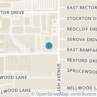
255 E Rampart Dr #104, San Antonio TX 78216
Public RecordsThe property at 255 E Rampart Dr #104, built in 1965, is a 702 square foot Residence and has 1 bedrooms and 1 bathrooms. It is situated on a lot that is 1699 square feet and was last tax assessed in 2023 for a valuation of $81,040
The estimate for this property has experienced a 1.25% increase in the past 7 months reaching a value of $110,363.
- Parcel Number12025-201-1040
- Sold Date06/13/2023
- Sold PriceUnknown/Redacted
- CountyBEXAR
- Stories1
- Home Assessment$66,900
- Land Assessment$14,140
- Total Assessment$81,040
- Assessment Year2023
- Tax Year2023
- Tax Amount$1,860
Property Tax History
Source: Public Records
| Year | Assessment |
|---|---|
| 2023 | $81,040 |
| 2022 | $81,040 |
| 2021 | $81,040 +65.39% |
| 2020 | $49,000 -26.87% |
| 2019 | $67,000 +36.73% |
| 2018 | $49,000 +23.71% |
| 2017 | $39,610 +55.94% |
| 2016 | $25,400 +11.35% |
| 2015 | $22,810 +2.38% |
| 2013 | $22,280 |
Valuation History
Source: Public Records
*Market History, including Median Sales Price per square foot, and Single Family Homes Sold is based on historical data of Zip Code: 78216 - TX
Nearby Schools
Source: School Digger
Population & Environment
Source: Sperling's Best Places
Nearby Properties
-
![Photo of 255 E RAMPART DR 110 #110]() $129,000 Active
$129,000 Active2 bds • 1 ba • 846 sqft
255 E RAMPART DR 110 #110, San Antonio, TX 78216
Centrally located 2 bedroom 1 bathroom condo close to NorthStar Mall, 410, 1604, San Antonio Airport and 15 minutes from downtown. First floor location. Secure access and gated garage. Great rental potential! Washer/Dryer and Fridge INCLUDED -
![Photo of 255 E RAMPART DR 403 #403]() $109,000 Active
$109,000 Active1 bds • 1 ba • 672 sqft
255 E RAMPART DR 403 #403, San Antonio, TX 78216
Exceptional investment opportunity just moments away from San Antonio's thriving airport & North Star Mall. This condominium isn't just a property-it's a smart investment. With HOA fees right under $200, covering essential utilities like water and ga... -
![Photo of 8210 MCCULLOUGH AVE]() $335,000 Active
$335,000 Active4 bds • 3 ba • 2,025 sqft
8210 MCCULLOUGH AVE, San Antonio, TX 78216
-
![Photo of 8202 MCCULLOUGH AVE]() $462,500 Active
$462,500 Active4 bds • 3 ba • 2,358 sqft
8202 MCCULLOUGH AVE, San Antonio, TX 78216
This home has 3 bedrooms and 2 bathrooms with a fully equipped 1 bedroom, 1 Bathroom, mother-in-law suite boasting a full sized kitchen, living area and access to the backyard's large covered patio - perfect for multigenerational family living or inv... -
![Photo of 165 W. Rampart 508 #508]() $1,495 Active
$1,495 Active2 bds • 2 ba • 0 sqft
165 W. Rampart 508 #508, San Antonio, TX 78216
Completely make over, painted in and out. Walking distance to North Star Mall, near airport, HEB and much more. Condo shows very well and rooms are very good size, can fit king beds in each bedroom if needed. -
![Photo of 165 W Rampart Dr 302 #302]() $176,000 Active
$176,000 Active2 bds • 2 ba • 1,060 sqft
165 W Rampart Dr 302 #302, San Antonio, TX 78216
Location, location location! This cozy condo brings a lot of updated features and is located in the middle of everything! This unit is in the highly desirable Rampart Crossing Condominiums minutes from 410 and North Star Mall. Meticulously maintained... -
![Photo of 371 REXFORD DR]() $275,000 Active
$275,000 Active3 bds • 2 ba • 1,147 sqft
371 REXFORD DR, San Antonio, TX 78216
CALLING ALL VINTAGE ENTHUSIASTS! This ADORABLE, CLEAN 1956 Ranch is looking for it's 2nd Chapter! Lovingly cared for by it's original owners, this single story haven exudes timeless charm and classic mid-century details! The original Hardwood floors... -
![Photo of 383 MILLWOOD LN]() $339,900 Active
$339,900 Active3 bds • 2 ba • 1,200 sqft
383 MILLWOOD LN, San Antonio, TX 78216
Click the Virtual Tour link to view the 3D walkthrough. Welcome to this charming three-bedroom, two-bathroom single-family ranch home nestled on an oversized corner lot, providing a spacious and fully fenced backyard for your enjoyment and privacy. A... -
![Photo of 526 STOCKTON DR]() $335,000 Active
$335,000 Active3 bds • 2 ba • 1,650 sqft
526 STOCKTON DR, San Antonio, TX 78216
Just minutes from The Pearl, The Riverwalk and the buzzing downtown San Antonio excitement, you will find this beautiful 1600 sqft -3 bedroom/ 2 bath gem. This beautiful home is in a well established and stable neighborhood in the heart of San Antoni... -
![Photo of 411 Sprucewood Lane]() $332,500 Active
$332,500 Active3 bds • 2 ba • 1,351 sqft
411 Sprucewood Lane, San Antonio, TX 78216
Location, Location, Location! This stunning 3 bed, 2 bath and 1 bonus room midcentury gem, has undergone a meticulous and stylish full renovation, offering a perfect blend of modern luxury and timeless charm. Step into an open and inviting open floor... -
![Photo of 418 REXFORD DR]() $2,400 Active
$2,400 Active4 bds • 2 ba • 2,328 sqft
418 REXFORD DR, San Antonio, TX 78216
Charming home located minutes from shopping several major highways and more. Offering two living room spaces and open floorplan. -
![Photo of 422 REXFORD DR]() $310,000 Active
$310,000 Active3 bds • 2 ba • 1,160 sqft
422 REXFORD DR, San Antonio, TX 78216
Gorgeous recently updated 3 bed 2 bath! This home features a spacious floorplan with vinyl plank flooring, and tons of upgrades throughout. Prepare delicious meals in the newly renovated kitchen featuring granite counters, white cabinets, subway tile... -
![Photo of 157-161 Nespral]() $565,000 Active
$565,000 Active8 bds • 6 ba • 3,352 sqft
157-161 Nespral, San Antonio, TX 78253
Introducing this brand-new duplex strategically nestled in a prime location within Amanda Park. Boasting proximity to top-tier educational institutions and a plethora of shopping options, this residence offers the ideal blend of convenience and luxur... -
![Photo of 121-125 Nespral]() $545,000 Active
$545,000 Active6 bds • 4 ba • 2,968 sqft
121-125 Nespral, San Antonio, TX 78253
Introducing this brand-new duplex strategically nestled in a prime location within Amanda Park. Boasting proximity to top-tier educational institutions and a plethora of shopping options, this residence offers the ideal blend of convenience and luxur... -
![Photo of 219 BEECHWOOD]() $750,000 Active
$750,000 Active4 bds • 3 ba • 3,668 sqft
219 BEECHWOOD, San Antonio, TX 78216
Step into this immaculate midcentury one story home and you will be amazed by the attention to details. From the standing seam metal roof to the Pella windows and doors, this home features high end finishes throughout. With over 3600 square feet, you... -
![Photo of 119 MAPLEWOOD LN]() $375,000 Active
$375,000 Active3 bds • 2 ba • 1,781 sqft
119 MAPLEWOOD LN, San Antonio, TX 78216
Welcome to 119 Maplewood Ln, a beautifully updated mid-century modern gem nestled on over a quarter-acre lot with mature trees in the heart of San Antonio. This stunning property combines classic charm with modern convenience, making it the perfect s... -
![Photo of 450 SENOVA DR]() $249,900 Active
$249,900 Active3 bds • 2 ba • 1,096 sqft
450 SENOVA DR, San Antonio, TX 78216
This charming single-story home features three bedrooms and two bathrooms with original wood floors, creating a sense of spaciousness throughout its generously sized square footage. The kitchen is equipped with a dual oven and includes an inviting ea... -
![Photo of 358 Springwood Ln]() $249,900 Active
$249,900 Active3 bds • 2 ba • 1,995 sqft
358 Springwood Ln, San Antonio, TX 78216
Single Story Midcentury Modern, Ranch Style Home - Recently updated and Completely Move In Ready - Spacious Living Areas - Large Eat In/Island Kitchen - Three Spacious Bedrooms - Updated Bathrooms with Large Walk In Showers - Excellent Location Just... -
![Photo of 415 Sandalwood Ln]() $290,000 Active
$290,000 Active3 bds • 2 ba • 1,240 sqft
415 Sandalwood Ln, San Antonio, TX 78216
This adorable house is move in ready. The updated kitchen includes stainless appliances, white cabinets, and granite counter tops. Enjoy a location convenient to highways, shopping, and restaurants. 5 minutes away from the Quarry and Airport. Enjoy a... -
![Photo of 415 Sandalwood Ln]() $1,900 Active
$1,900 Active3 bds • 2 ba • 0 sqft
415 Sandalwood Ln, San Antonio, TX 78216
This adorable house is move in ready. The updated kitchen includes stainless appliances, white cabinets, and granite counter tops. Enjoy a location convenient to highways, shopping, and restaurants. 5 minutes away from the Quarry and Airport. Enjoy a...


