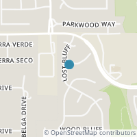
10520 Lost Blf, San Antonio TX 78240
Public RecordsThe property at 10520 Lost Blf, built in 1992, is a 2,470 square foot Residence and has 4 bedrooms and 3 bathrooms. It is situated on a lot that is 5489 square feet and was last tax assessed in 2022 for a valuation of $264,320
The estimate for this property has experienced a 4.01% increase in the past 12 months reaching a value of $323,472.
- Parcel Number19110-005-0310
- Sold Date08/26/2020
- Sold PriceUnknown/Redacted
- CountyBEXAR
- Stories2
- Home Assessment$210,520
- Land Assessment$71,780
- Total Assessment$282,300
- Assessment Year2023
- Tax Year2022
- Tax Amount$6,543
Property Tax History
Source: Public Records
| Year | Assessment |
|---|---|
| 2022 | $264,320 -6.37% |
| 2021 | $282,300 +43.15% |
| 2020 | $197,210 -9.98% |
| 2019 | $219,080 +18.77% |
| 2018 | $184,460 +20.45% |
| 2017 | $153,140 -2.45% |
| 2016 | $156,980 +5.72% |
| 2015 | $148,490 +8.17% |
| 2013 | $137,270 |
Valuation History
Source: Public Records
*Market History, including Median Sales Price per square foot, and Single Family Homes Sold is based on historical data of Zip Code: 78240 - TX
Nearby Schools
Source: School Digger
Population & Environment
Source: Sperling's Best Places
Click Zestimate price to view details on Zillow. Zestimate data is provided "as is" via the Zestimate API. © Zillow, Inc., 2006-2022. Use is subject to Terms of Use.
Nearby Properties
-
![Photo of 10531 Lost Bluff]() $1,850 Active
$1,850 Active4 bds • 3 ba • 2,300 sqft
10531 Lost Bluff, San Antonio, TX 78240
Large 2,300 sq. ft. 4 bedroom 2 1/2 bath 2 car garage in desirable Oak Bluff Subdivision. Home features large living room 21 x 17 and long kitchen in an open floor plan. First floor has ceramic tile. All bedrooms upstairs and have carpet or wood viny... -
![Photo of 7714 Autumn Bluff]() $328,000 Active
$328,000 Active4 bds • 3 ba • 2,300 sqft
7714 Autumn Bluff, San Antonio, TX 78240
Check out this fantastic two-story gem in OAK BLUFF! This beauty boasts four cozy bedrooms and sits pretty on a lush greenbelt lot surrounded by mature trees. The living room is ideal for throwing parties for family and friends. The cheerful, galley-... -
![Photo of 7627 Flower Bluff]() $1,750 Active
$1,750 Active3 bds • 2 ba • 1,720 sqft
7627 Flower Bluff, San Antonio, TX 78240
Charming one story move in ready with great access to Ih10, 1604 and utsa. Step inside and enjoy tile throughout. Extremely well thought thru floorplan with kitchen, dining and family room. Great walk in closet in owner retreat and spacious bedroom.... -
![Photo of 7720 FLOWER BLF]() $299,000 Active
$299,000 Active3 bds • 2 ba • 1,532 sqft
7720 FLOWER BLF, San Antonio, TX 78240
Welcome to 7720 Flower Bluff, a stunning property nestled in the heart of San Antonio. This home offers a blend of elegance and comfort, boasting impeccable curb appeal and pristine interiors throughout. As you step inside, you're greeted by an invit... -
![Photo of 7931 SIERRA VERDE]() $2,100 Active
$2,100 Active3 bds • 2 ba • 1,675 sqft
7931 SIERRA VERDE, San Antonio, TX 78240
LOVELEY 3BR 2BTH HOME IN GATED COMMUNITY! This lovely 3BR 2BTH, 1675 SQ FT home in the gated community of offer all kitchen appliances, a complete private fenced in backyard, and all the amenities a family would need. Be the first to call this house... -
![Photo of 10211 ELIZABETH CT]() $2,850 Active
$2,850 Active4 bds • 3 ba • 2,602 sqft
10211 ELIZABETH CT, San Antonio, TX 78240
Location, location! Fantastic opportunity to live in the heart of it ALL in a small, quaint boutique community across from OP Schnabel Park. Situated on a corner lot, this beautiful 4 bedroom, 2 1/2 bath home has room for everyone. As you enter, a st... -
![Photo of 10806 hillsdale loop]() $314,900 Active
$314,900 Active3 bds • 3 ba • 2,420 sqft
10806 hillsdale loop, San Antonio, TX 78249
Light bright and open -
![Photo of 7723 AUTUMN PARK]() $364,000 Active
$364,000 Active4 bds • 3 ba • 2,392 sqft
7723 AUTUMN PARK, San Antonio, TX 78249
Welcome to your dream home in the heart of Parkwood Subdivision! This stunning 4 bed, 2.5 bath gem offers the perfect blend of space, comfort, and convenience. Spanning 2,392 sq. ft. across two stories, this home sits on a generous 0.21-acre lot, boa... -
![Photo of 8060 PRUE RD]() $900,000 Active
$900,000 Active3 bds • 3 ba • 2,867 sqft
8060 PRUE RD, San Antonio, TX 78249
Commercial Potential!! Property has a single-family home with 2907 perimeter sqft. living area and 2676 perimeter sqft. unfinished basement, 4-Car detached garage, large exterior building on slab w/a 20-foot eave height used as a RV Garage or worksho... -
![Photo of 7707 AUTUMN PARK]() $334,900 Active
$334,900 Active4 bds • 3 ba • 2,491 sqft
7707 AUTUMN PARK, San Antonio, TX 78249
Great 4 bedroom 2.5 bath home with attached garage in the established Parkwood Subdivision. Some of this homes features include a large open floor plan, island kitchen, two eating areas, fireplace, large walk in pantry, large backyard with patio, and... -
![Photo of 11011 pomona park]() $335,000 Active
$335,000 Active3 bds • 2 ba • 2,447 sqft
11011 pomona park, San Antonio, TX 78249
Welcome to 11011 Pomona Park Dr. located in the quiet, desirable Parkwood Subdivision! Step into a world of warmth and comfort as you enter the open-concept living space, perfect for creating lasting memories with loved ones. If blue is not your colo... -
![Photo of 8006 Misty Bluff]() $2,100 Active
$2,100 Active3 bds • 3 ba • 2,420 sqft
8006 Misty Bluff, San Antonio, TX 78249
Nice 3 bed, 2.5 bath home in a quiet, desirable neighborhood, over 2400 SQFT, open floor plan, with 2 living areas & 2 dining areas. Family room w/ a corner fireplace, game room upstairs, or second family room. Huge master bedroom with separate garde... -
![Photo of 10910 Hillsdale Loop]() $354,000 Active
$354,000 Active4 bds • 3 ba • 2,695 sqft
10910 Hillsdale Loop, San Antonio, TX 78249
This spacious 2695 sq-ft brick home is ideally situated in close proximity to La Cantera, Medical Center and the University of San Antonio. Nestled in an area with great schools (Northside ISD), it offers both comfort and convenience for a vibrant li... -
![Photo of 7603 AUTUMN PARK]() $339,900 Active
$339,900 Active3 bds • 2 ba • 2,227 sqft
7603 AUTUMN PARK, San Antonio, TX 78249
Prepare to fall in LOVE with this FABULOUS one story in Parkwood that has been immaculately maintained! Light, bright open floor plan that simply lives WELL! There is an island kitchen to live around featuring dimmable over and under cabinet lighting... -
![Photo of 11090 CEDAR PARK]() $325,000 Active
$325,000 Active3 bds • 3 ba • 2,575 sqft
11090 CEDAR PARK, San Antonio, TX 78249
**OPEN HOUSE Friday, 4/19 from 3pm-6pm**Discover the charm of this inviting two-story home featuring three bedrooms and 2.5 bathrooms. With two living areas, there's ample space for relaxation and entertaining. The absence of carpet throughout the ho... -
![Photo of 11097 CEDAR PARK]() $2,495 Active
$2,495 Active4 bds • 3 ba • 3,478 sqft
11097 CEDAR PARK, San Antonio, TX 78249
Property qualifies for$0 cash deposit (subject to approval)!Online App fee$65, Paper App fee $75,18 and over. App/fees are due at time of application.Pet fee/mo, per pet starting at $15 (subject to restrictions & approval).$75 lease admin fee after a... -
![Photo of 11203 POMONA PARK DR]() $2,395 Active
$2,395 Active4 bds • 2 ba • 1,915 sqft
11203 POMONA PARK DR, San Antonio, TX 78249
Beautiful "like new" 1 story, 4 Bedroom/2 Bath home in Pomona Park. Beautiful Vynyl Floors entire home, granite counter tops in kitchen with stainless steel appliances. General Instructions/Directions: Take IH10, turn left onto Huebner Rd, Turn right... -
![Photo of 7011 JADE FIELD]() $1,995 Active
$1,995 Active4 bds • 3 ba • 2,571 sqft
7011 JADE FIELD, San Antonio, TX 78240
Fantastic 2 story home with 4 Bedrooms in Westfield. Open floor plan with 2 super sized living areas. Large Kitchen with separate eating area plus a large separate Dining Room. Spacious walk in pantry/laundry area. Primary Bedroom so large it has to... -
![Photo of 10834 WILSON OAKS]() $2,600 Active
$2,600 Active3 bds • 3 ba • 2,233 sqft
10834 WILSON OAKS, San Antonio, TX 78249
Intimate Gated one Street Neighborhood.... Splash! Yes, this home does include an HOA community pool to enjoy this summer! 3 Deck areas to enjoy! Soaring ceilings with a cozy fireplace makes this house feel like home. Open Floor plan with 2nd dining... -
![Photo of 11027 Candle Park]() $299,900 Active
$299,900 Active3 bds • 2 ba • 1,397 sqft
11027 Candle Park, San Antonio, TX 78249
Welcome to 11027 Candle Park, nestled in the heart of San Antonio, TX 78249. This charming home boasts an array of upgrades, including a brand-new HVAC system and renovated bathrooms, ensuring modern comfort and convenience. The primary bedroom offer...


