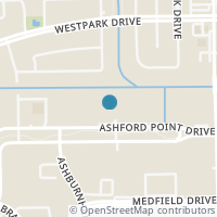
12660 Ashford Point Dr #718, Houston TX 77082
Public RecordsThe property at 12660 Ashford Point Dr #718, built in 1984, is a 624 square foot Residence and has 1 bedrooms and 1 bathrooms. It is situated on a lot that is 5872 square feet and was last tax assessed in 2023 for a valuation of $89,398
The estimate for this property has experienced a -6.15% decrease in the past 7 months reaching a value of $83,517.
- Parcel Number1161320070018
- Sold Date10/15/2004
- Sold PriceUnknown/Redacted
- CountyHARRIS
- Stories1
- Home Assessment$72,412
- Land Assessment$16,986
- Total Assessment$89,398
- Assessment Year2023
- Tax Year2020
- Tax Amount$653
Property Tax History
Source: Public Records
| Year | Assessment |
|---|---|
| 2022 | $66,923 |
| 2021 | $66,923 -25.14% |
| 2020 | $89,398 +73.40% |
| 2019 | $51,556 |
| 2018 | $51,556 +5.05% |
| 2017 | $49,079 +14.93% |
| 2016 | $42,703 +23.15% |
| 2015 | $34,677 |
| 2013 | $34,677 +25.22% |
| 2012 | $27,692 |
Valuation History
Source: Public Records
*Market History, including Median Sales Price per square foot, and Single Family Homes Sold is based on historical data of Zip Code: 77082 - TX
Nearby Schools
Source: School Digger
Population & Environment
Source: Sperling's Best Places
Click Zestimate price to view details on Zillow. Zestimate data is provided "as is" via the Zestimate API. © Zillow, Inc., 2006-2022. Use is subject to Terms of Use.
Nearby Properties
-
![Photo of 12660 Ashford Point Drive #607]() $129,000 Active
$129,000 Active2 bds • 2 ba • 829 sqft
12660 Ashford Point Drive #607, Houston, TX 77082
DON'T MISS OUT ON THIS LOVELY TWO BEDROOM TWO BATHROOM CONDO. NESTLED IN A LOVELY AND QUIETCOMPLEX WITH A POOL. SO MANY UPDATES!!! NEW AIRCONDITIONER UNIT, REMODELED BATHROOMS WITH WALK-IN SHOWERS. NEW BATHROOM COUNTERSTOPS, AND BATHROOM FIXTURES. RE... -
![Photo of 12660 Ashford Point Drive #811]() $113,000 Active
$113,000 Active2 bds • 2 ba • 829 sqft
12660 Ashford Point Drive #811, Houston, TX 77082
Welcome home with 2 bedrooms & 2 full baths. Conveniently located condo, well-maintained in the first level at the Westchase area of Houston. Just minute to Asian restaurants , Asian market and shopping near by, located near Westpark Toll Road and me... -
![Photo of 12660 Ashford Point Drive #811]() $1,500 Active
$1,500 Active2 bds • 2 ba • 829 sqft
12660 Ashford Point Drive #811, Houston, TX 77082
Welcome home with 2 bedrooms & 2 full baths. Conveniently located condo, well-maintained in the first level at the Westchase area of Houston. Just minute to Asian restaurants , Asian market and shopping near by, located near Westpark Toll Road and me... -
![Photo of 12660 Ashford Point Drive #207]() $1,250 Active
$1,250 Active2 bds • 2 ba • 829 sqft
12660 Ashford Point Drive #207, Houston, TX 77082
Location! Location! A cozy unit with a split floorplan with 2 bedrooms and 2 bathrooms for your perfect living situation.Updated kitchen with Granite and New black appliances. Great space with New flooring and walk-in closets, New Stackable washer an... -
![Photo of 12660 Ashford Point Drive #303]() $77,000 Active
$77,000 Active1 bds • 1 ba • 624 sqft
12660 Ashford Point Drive #303, Houston, TX 77082
Beautiful 1 bed 1 bath on the first floor, tile flooring. Spacious master bedroom. Nice patio. Washer, dryer and refrigerator are included. Gated Community with a nice pool and lot of trees and green. walking access to shopping stores and easy access... -
![Photo of 12660 Ashford Point Drive #714]() $78,000 Active
$78,000 Active1 bds • 1 ba • 624 sqft
12660 Ashford Point Drive #714, Houston, TX 77082
Lovely unit in a gated community offers convenient access to dining, shopping & entertainment. Move-in ready and situated on the 2nd level, ensuring ample privacy. Refrigerator, washer & dryer are included. Don't miss out on this exceptional opportun... -
![Photo of 12713 Westpark Drive]() $180,000 Active
$180,000 Active3 bds • 2 ba • 1,609 sqft
12713 Westpark Drive, Houston, TX 77082
Welcome to this charming patio residence nestled in the Alief Area of Houston. This property, offered in its current condition, showcases a vintage furnace dating back to 1998, a roof installed in 1999, and an air conditioning system from 1998. Despi... -
![Photo of 3710 W Ashford Villa Lane]() $1,995 Active
$1,995 Active4 bds • 3 ba • 1,818 sqft
3710 W Ashford Villa Lane, Houston, TX 77082
Excellent 2 story single family home built in 2007. The homes recent vinyl plank sown stair, new carpet, fresh interior painting, highs ceilings, open floor concept floor plan, primary bath with separate shower and tub and good size for secondary bed... -
![Photo of 12502 N Ashford Villa Lane]() $269,990 Active
$269,990 Active3 bds • 3 ba • 2,003 sqft
12502 N Ashford Villa Lane, Houston, TX 77082
-
![Photo of 3415 Ashfield Drive]() $3,000 Active
$3,000 Active4 bds • 4 ba • 2,801 sqft
3415 Ashfield Drive, Houston, TX 77082
Beautiful large 2 story custom home available for rent in a very convenient location near Westchase and Energy Corridor. 4 bedrooms 3 full bathrooms and half bath, the subdivision Ashton Village is a very quiet quaint neighborhood that is highly desi... -
![Photo of 3503 Denio Drive]() $208,000 Active
$208,000 Active4 bds • 3 ba • 2,059 sqft
3503 Denio Drive, Houston, TX 77082
-
![Photo of 12906 Brant Rock Drive #09]() $899 Active
$899 Active1 bds • 1 ba • 680 sqft
12906 Brant Rock Drive #09, Houston, TX 77082
Classic Unit. Washer & Dryer Provided. Experience a slice of peaceful city life at Brant Rock apartments in Houston, Texas. Our charming community is conveniently located close to Westpark Tollway, so commuting around is easy. Residents are encourage... -
![Photo of 12906 Brant Rock Drive #68]() $899 Active
$899 Active1 bds • 1 ba • 750 sqft
12906 Brant Rock Drive #68, Houston, TX 77082
Upgraded Unit. Quartz Counter Tops. Washer & Dryer Provided. Experience a slice of peaceful city life at Brant Rock apartments in Houston, Texas. Our charming community is conveniently located close to Westpark Tollway, so commuting around is easy. R... -
![Photo of 12906 Brant Rock Drive #14]() $1,031 Active
$1,031 Active1 bds • 1 ba • 750 sqft
12906 Brant Rock Drive #14, Houston, TX 77082
Upgraded Unit. Quartz Counter Tops. Washer & Dryer Provided. Experience a slice of peaceful city life at Brant Rock apartments in Houston, Texas. Our charming community is conveniently located close to Westpark Tollway, so commuting around is easy. R... -
![Photo of 12906 Brant Rock Drive #80]() $899 Active
$899 Active1 bds • 1 ba • 750 sqft
12906 Brant Rock Drive #80, Houston, TX 77082
Upgraded Unit. Quartz Counter Tops. Washer & Dryer Provided. Experience a slice of peaceful city life at Brant Rock apartments in Houston, Texas. Our charming community is conveniently located close to Westpark Tollway, so commuting around is easy. R... -
![Photo of 12906 Brant Rock Drive #02]() $950 Active
$950 Active2 bds • 2 ba • 780 sqft
12906 Brant Rock Drive #02, Houston, TX 77082
Classic Unit. Washer & Dryer Provided. Experience a slice of peaceful city life at Brant Rock apartments in Houston, Texas. Our charming community is conveniently located close to Westpark Tollway, so commuting around is easy. Residents are encourage... -
![Photo of 12906 Brant Rock Drive #44]() $950 Active
$950 Active2 bds • 2 ba • 780 sqft
12906 Brant Rock Drive #44, Houston, TX 77082
Classic Unit. Washer & Dryer Provided. Experience a slice of peaceful city life at Brant Rock apartments in Houston, Texas. Our charming community is conveniently located close to Westpark Tollway, so commuting around is easy. Residents are encourage... -
![Photo of 12906 Brant Rock Drive #72]() $900 Active
$900 Active2 bds • 1 ba • 780 sqft
12906 Brant Rock Drive #72, Houston, TX 77082
Classic Unit. Washer & Dryer Provided. Experience a slice of peaceful city life at Brant Rock apartments in Houston, Texas. Our charming community is conveniently located close to Westpark Tollway, so commuting around is easy. Residents are encourage... -
![Photo of 12906 Brant Rock Drive #11]() $899 Active
$899 Active1 bds • 1 ba • 750 sqft
12906 Brant Rock Drive #11, Houston, TX 77082
Upgraded Unit. Quartz Counter Tops. Washer & Dryer Provided. Experience a slice of peaceful city life at Brant Rock apartments in Houston, Texas. Our charming community is conveniently located close to Westpark Tollway, so commuting around is easy. R... -
![Photo of 12906 Brant Rock Drive #29]() $950 Active
$950 Active2 bds • 2 ba • 780 sqft
12906 Brant Rock Drive #29, Houston, TX 77082
Classic Unit. Washer & Dryer Provided. Experience a slice of peaceful city life at Brant Rock apartments in Houston, Texas. Our charming community is conveniently located close to Westpark Tollway, so commuting around is easy. Residents are encourage...


